Trust Your Geospatial Data

to the Experts

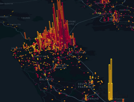
At ScaleApp, we build cutting-edge Geospatial solutions powered by open source technologies. Our expertise lies in selecting the right tools and following best practices to build scalable and high-performance systems that seamlessly integrate with your existing infrastructure.

standalone

Web & Mobile GIS development

We specialize in developing GIS and Remote Sensing applications that run at web speed, providing users with fast, real-time access to geospatial data. Our web-based GIS solutions are built using the latest open source technologies such as GeoServer, OGC API, PostGIS, and OpenLayers or leaflet, ensuring full compliance with international standards for seamless integration and data sharing. Whether you’re in need of interactive maps, data visualization platforms, or large-scale geospatial solutions, our systems are engineered for performance, scalability, and ease of use across various industries.

standalone

Geospatial Data Management

We develop large-scale geodatabases for both vector and raster data, utilizing technologies such as PostGIS, GeoMesa, and Cloud Optimized GeoTIFF (COG) to build scalable database solutions. We also leverage geospatial servers to create and manage time series data, enabling advanced temporal analysis. Additionally, we create data catalogs that ensure proper classification and searchability for end users, based on European standards and OGC CSW (Catalogue Service for the Web) protocols.

standalone

Geospatial Analysis & Processing

Our team offers specialized geospatial analysis and thematic mapping services, providing key insights for decision-making across industries such as environmental monitoring, urban planning, infrastructure management, and logistics. Using technologies like RasterFrames for large-scale raster data analysis and GDAL for geospatial data transformation, we execute complex geospatial analytics and model spatial phenomena with precision. By leveraging OGC APIs and WPS , we transform complex geospatial processes into OGC-compliant web services, ensuring seamless integration and accessibility for your business needs.

standalone

IoT and Real-Time GIS Integration

We provide advanced IoT integration services, enabling real-time geospatial data collection and visualization. By connecting IoT devices and sensors to your GIS platform, we help you monitor, analyze, and react to spatial data as it happens. Using technologies like GeoMesa for big data streaming, Kafka for event processing, PostGIS for spatial queries, and Kassandra for managing time series data, we create systems that can ingest and process high-velocity data streams in real time.

standalone

We operate with a fully Dockerized environment

We ensure that all of our projects are delivered as containerized solutions, complete with the necessary dependencies. Whether you have a scientific model or a complex process, we prepare it as a fully Dockerized service with a micro API, seamlessly integrating it into the architecture of a geospatial system. This approach ensures consistency, scalability, and ease of deployment across any infrastructure.


Meet SPHEROID...
Your Geospatial Guardian for Peak Performance and Reliability.